BasalArea
by Forest Monitoring Tools
Basal Area calculation from 360 degree photos by using Bitterlich method.
| App Name | BasalArea |
|---|---|
| Developer | Forest Monitoring Tools |
| Category | Tools |
| Download Size | 5 MB |
| Latest Version | 3.0 |
| Average Rating | 0.00 |
| Rating Count | 0 |
| Google Play | Download |
| AppBrain | Download BasalArea Android app |


Basal Area application is designed for simple basal area calculation by using Bitterlich method like as Relascope survey.
Step 1 Take forest photos by 360 degree camera, and saved by Equi-rectangular format.
Step 2 Copy the photos to smartphone
Step 3 Open the file from "Basal Area" application
Step 4 Compare the trunk size (1.3m height) of trees with center red circle
Step 5 Tap "1.0" an case of the tree is bigger than red circle -> red mark
Tap "1.0" an case of the tree is bigger than red circle -> blue mark
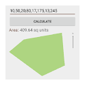
Step 6 Read the basal area data at the bottom of screen
- Count mark is deletable by tapping.
- Count-marked image is savable for the evidence of survey result.
- K factor is changeable (default number is 4.0)
- Counting data is saved to \Android\data\com.forest.BasalArea\YYYY-MM-DD.csv file
Recent changes:
Data list handling is added.
Step 1 Take forest photos by 360 degree camera, and saved by Equi-rectangular format.
Step 2 Copy the photos to smartphone
Step 3 Open the file from "Basal Area" application
Step 4 Compare the trunk size (1.3m height) of trees with center red circle
Step 5 Tap "1.0" an case of the tree is bigger than red circle -> red mark
Tap "1.0" an case of the tree is bigger than red circle -> blue mark
Step 6 Read the basal area data at the bottom of screen
- Count mark is deletable by tapping.
- Count-marked image is savable for the evidence of survey result.
- K factor is changeable (default number is 4.0)
- Counting data is saved to \Android\data\com.forest.BasalArea\YYYY-MM-DD.csv file
Recent changes:
Data list handling is added.