Geo-Quest
by IIASA Apps
Explore the outdoors and contribute to scientific research.
| App Name | Geo-Quest |
|---|---|
| Developer | IIASA Apps |
| Category | Tools |
| Download Size | 46 MB |
| Latest Version | 0.92 |
| Average Rating | 0.00 |
| Rating Count | 0 |
| Google Play | Download |
| AppBrain | Download Geo-Quest Android app |


Geo-Quest: Explore, Collect, Contribute
Geo-Quest is a mobile app for collecting high-quality ground reference data to improve AI models and remote-sensing applications. Whether you are a scientist, a researcher, or an outdoor enthusiast, Geo-Quest turns your field observations into valuable datasets for the global community.
Embark on Quests and Collect Data
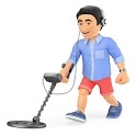
Join different campaigns focused on gathering essential information from the ground. Using your phone’s built-in sensors, including the camera, GPS, gyroscope, and accelerometer, Geo-Quest enhances data collection with cutting-edge features such as augmented reality.
Examples of Quests
- Tree-Quest – Measure individual tree attributes like diameter, height, and species to estimate aboveground biomass.
- Forest-Quest – Assess forest plots by measuring their basal area for ecological studies.
- Crop Capture – Record crop types, locations, and parcel boundaries on satellite imagery. Contribute to the ESA-funded WorldCereal project, supporting high-resolution global crop mapping.
Offline Mode and Open Data
No internet? No problem. Store satellite imagery, collect data offline, and upload it later. Your contributions are shared on the quest’s web platform and are openly available for the global community.
Download Geo-Quest today and start making a difference, one field observation at a time.
Recent changes:
- UI updated
- OpenID login added
- Some ui improvements
Geo-Quest is a mobile app for collecting high-quality ground reference data to improve AI models and remote-sensing applications. Whether you are a scientist, a researcher, or an outdoor enthusiast, Geo-Quest turns your field observations into valuable datasets for the global community.
Embark on Quests and Collect Data
Join different campaigns focused on gathering essential information from the ground. Using your phone’s built-in sensors, including the camera, GPS, gyroscope, and accelerometer, Geo-Quest enhances data collection with cutting-edge features such as augmented reality.
Examples of Quests
- Tree-Quest – Measure individual tree attributes like diameter, height, and species to estimate aboveground biomass.
- Forest-Quest – Assess forest plots by measuring their basal area for ecological studies.
- Crop Capture – Record crop types, locations, and parcel boundaries on satellite imagery. Contribute to the ESA-funded WorldCereal project, supporting high-resolution global crop mapping.
Offline Mode and Open Data
No internet? No problem. Store satellite imagery, collect data offline, and upload it later. Your contributions are shared on the quest’s web platform and are openly available for the global community.
Download Geo-Quest today and start making a difference, one field observation at a time.
Recent changes:
- UI updated
- OpenID login added
- Some ui improvements