Live Satellite View - GPS Map
by Funtech Studio
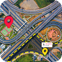
Live Satellite view earth map with GPS and 3D live street view of famous places.
| App Name | Live Satellite View - GPS Map |
|---|---|
| Developer | Funtech Studio |
| Category | Maps & Navigation |
| Download Size | 11 MB |
| Latest Version | 1.6 |
| Average Rating | 0.00 |
| Rating Count | 0 |
| Google Play | Download |
| AppBrain | Download Live Satellite View - GPS Map Android app |


Live Satellite View – GPS Map is a GPS navigator and interactive map app that will better your journey. Use this app for seamless navigation and exploration, with features such as satellite map, route finder, address finder, nearby places, my location, live street view, famous places, currency converter, find my car, area measure, distance calculator, speedometer, weather, compass, and translator.
Try 360-degree satellite view and get a better view of your surroundings in spectacular 3d with our live satellite map feature. Explore your surroundings with live, real-time updates of your location via live street view, and use GPS to get accurate and up-to-date directions. With the route finder and GPS driving route choices, you can easily plan your travel and arrive at your destination on time. Whether you're exploring city streets or visiting iconic landmarks, our GPS maps traffic feature keeps you up to date on the best routes to avoid traffic.
Discover local sites with our local sites tool, and our location guide may help you identify and locate notable spots all across the world. With the Find My Car feature, you'll never get lost again, making parking stress-free as it directs you back to your parked vehicle. Our street view app has many tools for travelers and explorers, such as a land measure tool, a speedometer, weather updates, a compass for orientation, and a translator for overcoming language barriers. With live satellite view, you can access a variety of features such as a speedometer, compass, and currency converter, all of which are designed to make your journeys easier.
Key features of Live Satellite View
✔ Precise GPS navigation for easy travelling through city streets and roads.
✔ Real-time updates and live views via live street view and live maps location tracker.
✔ Useful tools like currency converter, land measure, distance calculator, speedometer, and translator for enhanced convenience during your travels.
✔ Great experiences with satellite map, 3d satellite view, and realistic visual maps.
✔ Effortless direction finding with GPS route finder and voice GPS capabilities.
Live Satellite View – GPS Map provides a realistic visual experience with real-time updates and realistic maps, as well as correct instructions to your chosen location. With voice GPS and voice-over navigation, you can easily control and navigate through towns and streets, ensuring you arrive at your destination. Live Satellite View is more than just a map app; it's your personal location guide, complete with voice GPS and live map satellite functionality.
With live earth HD and live map satellite, you can see the world in spectacular detail and get a real-time perspective of your location and surroundings. For extra protection and peace of mind, use the GPS tracking route and GPS location tracker functions to track your movements.
Download Live Satellite View – GPS Map now and easily explore the world around you. Use our app for precise directions, real-time updates, and a more enjoyable travel experience. Live satellite view lets you experience the future of navigation.
Recent changes:
- Live satellite view and GPS navigation
- Tools included speedometer, find my car, language translator and more...
Try 360-degree satellite view and get a better view of your surroundings in spectacular 3d with our live satellite map feature. Explore your surroundings with live, real-time updates of your location via live street view, and use GPS to get accurate and up-to-date directions. With the route finder and GPS driving route choices, you can easily plan your travel and arrive at your destination on time. Whether you're exploring city streets or visiting iconic landmarks, our GPS maps traffic feature keeps you up to date on the best routes to avoid traffic.
Discover local sites with our local sites tool, and our location guide may help you identify and locate notable spots all across the world. With the Find My Car feature, you'll never get lost again, making parking stress-free as it directs you back to your parked vehicle. Our street view app has many tools for travelers and explorers, such as a land measure tool, a speedometer, weather updates, a compass for orientation, and a translator for overcoming language barriers. With live satellite view, you can access a variety of features such as a speedometer, compass, and currency converter, all of which are designed to make your journeys easier.
✔ Precise GPS navigation for easy travelling through city streets and roads.
✔ Real-time updates and live views via live street view and live maps location tracker.
✔ Useful tools like currency converter, land measure, distance calculator, speedometer, and translator for enhanced convenience during your travels.
✔ Great experiences with satellite map, 3d satellite view, and realistic visual maps.
✔ Effortless direction finding with GPS route finder and voice GPS capabilities.
Live Satellite View – GPS Map provides a realistic visual experience with real-time updates and realistic maps, as well as correct instructions to your chosen location. With voice GPS and voice-over navigation, you can easily control and navigate through towns and streets, ensuring you arrive at your destination. Live Satellite View is more than just a map app; it's your personal location guide, complete with voice GPS and live map satellite functionality.
With live earth HD and live map satellite, you can see the world in spectacular detail and get a real-time perspective of your location and surroundings. For extra protection and peace of mind, use the GPS tracking route and GPS location tracker functions to track your movements.
Download Live Satellite View – GPS Map now and easily explore the world around you. Use our app for precise directions, real-time updates, and a more enjoyable travel experience. Live satellite view lets you experience the future of navigation.
Recent changes:
- Live satellite view and GPS navigation
- Tools included speedometer, find my car, language translator and more...